In order to cope with the large number of tourists expected in the city during the Commonwealth Games, various authorities managing different aspects of public transport have massive expansion plans going on.
Delhi has a proposed a four-lane, 2.2 km underground stretch from Ring Road to Lodhi, linking the Games Village to the Jawaharlal Nehru Stadium and reducing traveling time for athletes traveling between the Village and the Stadium by six minutes. In response to concerns over the large number of trains that pass by the Delhi metropolitan region daily, construction of road under-bridges and over-bridges along railway lines has been started. To expand road infrastructure, flyovers, cloverleaf flyovers, and bridges have been planned to provide connectivity to the Games Village, to sports venues, to hospitals, and for intra-city connectivity.
Road-widening projects have been under process, with an emphasis being placed on expanding national highways. To improve traffic flow on existing road, plans are underway to make both the inner and outer Ring roads signal free. To support its commitment to mass transportation, nine corridors have been identified and are being constructed as High Capacity Bus Systems (for example, one from Ambedkar Nagar to Red Fort). Six of these corridors are expected to be operational by the end of 2008.
For the Commonwealth Games, there are plans for special additional 200 AC buses for the athletes and their families and park and drive facility for other commuters apart from giving as many buses as required for the people going to the main venue as not everyone would be able to take their vehicles to the main venue. This will be part of the general expansion plans, and will start two-three months before the start of the Commonwealth Games. To meet the transport demand by buses, it is estimated that the future number of buses will have to be increased to at least two and half times in addition to the number of personalized vehicles which is estimated to grow at least threefold. It is also estimated that 148 kms of additional roads with associate infrastructure such as flyovers, bus terminals, maintenance depots and car parks will be required, the work for which is going on right now. Under the action plan of the Delhi government, buses run by small operators will be replaced by 2010 by companies which will be given permission to run various routes chosen through a bidding process. Companies like Orix, ILFS, SRS Travels and some other logistical companies have shown interest in the project.
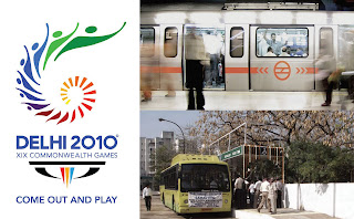
Aditionally, the Delhi Mass Rapid Transit System (Delhi Metro) will be expanded to accommodate more people and boost the use of public transportation during the 2010 games. By then it will have the second longest network in the world and later the longest, which will be more than 420 km and to achieve this exponential increase in the network’s length, the Delhi Metro has deployed a large number of tunnel boring machines and becoming one of Asia’s very few countries to put such a number of TBMs at work simultaneously.
In order to carry on the expansion in the Delhi Metro which poses problem with acquiring land, uninterrupted construction and as several roads or railway lines cross the alignment an elevated section has been proposed. Under ground option has been adopted only in the busy congested areas and the walled city. The total length in Phase-II, which is the one proposed to be completely functional by the year 2010, will be about 53.02 kms. The underground constructions will involve 4.55 km bored tunneling and 2.693 km cut and cover.


